

UGANDA, Kampala | Real Muloodi News | If you’re buying land, or buying a property with the intention of making major renovations or developments to it, you should know about land surveying, says Spectrum Real Estate Solutions.
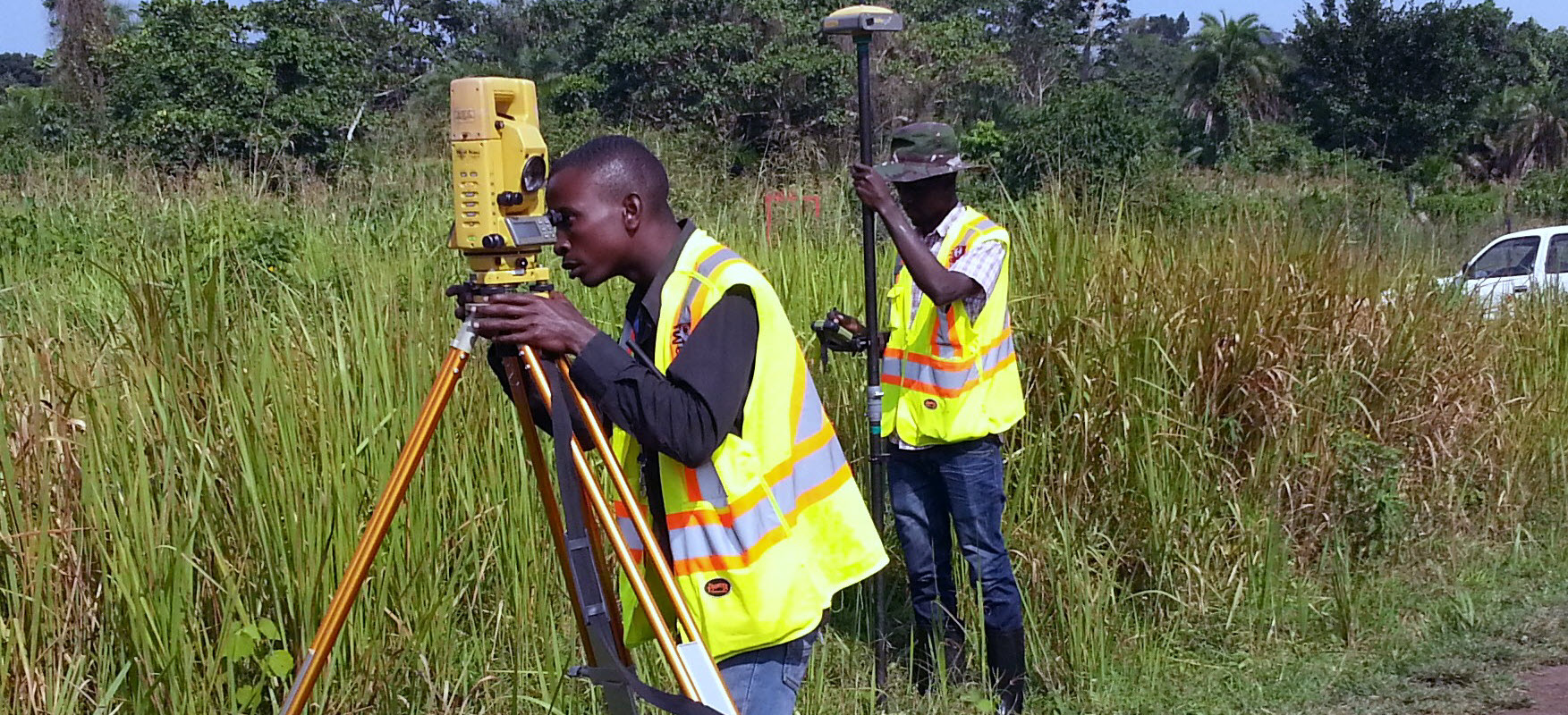
A surveyor can help you find out the boundary measurements of the land that you plan to buy. Their expertise is necessary to authenticate a land survey with the title deed. Experienced surveyors use sensitive tools, such as a theodolite, to measure land, location of roads, buildings, topography, and property lines to confirm the validity of property deeds.
Surveyors can also help you understand zoning and building regulations. If you wish to buy land to develop or build on, they can help you identify potential problems and look for solutions.
Surveyors can also determine if there is an intrusion or encroachment on the property; for instance, a portion of a neighbour’s structure stands on your prospective land.
Before constructing anything that is likely to approach the property line, such as a fence, it is important to engage a surveyor to locate the boundaries of the property on the ground, as described in your deed.
Surveyors should be the first people on any construction site to measure and map out the land. Architects then use these primary measurements to understand and make the most of the unique landscape when designing. Engineers use surveyors’ information to plan structures accurately and safely, ensuring buildings are constructed to fit with the landscape.
Dr. Ronald Sengendo, President Uganda Institution of Surveyors (ISU) defines surveying as the science of delineating property boundaries and physical features of the earth; and survey of mineral properties; and the computation of areas, volumes and other quantities; as well as the preparation of maps and plans.

According to Spectrum, surveying a piece of land takes four stages:
1. Planning
After an initial reconnaissance field visit, planning decides:
- The methods to be adopted for surveying;
- The resources (instruments & personnel) to be used;
- The control points / stations to be used (those already available and/ or to set up).
2. Field Observation
Field observation involves:
- Collection of field data by making necessary measurements;
- Recording of observed data systematically. Before starting any field observation, the adjustments of all the instruments need to be examined and calibrated by trained personnel.
3. Officeworks
The third stage takes the process to the Office. It involves:
- Processing, analysing and calculation of observed data;
- Preparation of necessary data (for making plan or map of the area);
- Making of a plan or map of the area;
- Computation of relevant field parameters as per design for setting out engineering works at site.
4. Setting Out Works
To locate and establish different parameters / dimensions at the site as per design for further engineering works. This aids in the process of developing the land, avoiding disputes, improving the value of the land in question and securing it.
It is important to only use qualified and registered Surveyors. The Institution of Surveyors (ISU), website emphasizes this. It is stipulated on the website that, “No person shall practice surveying in Uganda, unless one is a member of the Institution. The Surveyors’ Registration Board shall register members on the recommendation of the Institution. ISU shall nominate and recommend members to the Minister for appointment to the Surveyors’ Registration Board”.
READ MORE LIKE THIS: