

UGANDA, Kampala | Real Muloodi News | As Uganda’s towns expand and infrastructure projects rise, the need for accurate land surveying has become more urgent than ever. Experts say land surveying in Uganda plays a vital role in defining ownership, resolving disputes, and supporting investment across agriculture, real estate, and industrial development.
In many districts, disputes often arise from unclear or overlapping boundaries. A case in point is that of a family in Ntungamo whose farmland boundaries were marked only by trees and anthills for decades. When encroachment began, a professional surveyor was hired to demarcate and document the land officially, resulting in a clear record that later helped secure a title.
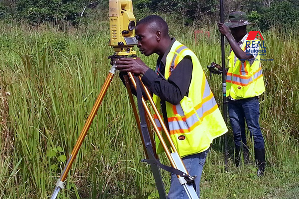
Land surveying in Uganda involves several categories of professionals — including land surveyors, quantity surveyors, valuation surveyors, and engineering surveyors. Each plays a unique part in determining property lines, valuing assets, and ensuring that infrastructure is developed within approved limits.
Licensed surveyors use tools such as GPS, drones, and GIS mapping systems to produce accurate data for both government and private clients. These technologies have reduced boundary conflicts and improved urban planning accuracy.
The Ministry of Lands, Housing, and Urban Development has introduced the Uganda National Land Information System (UgNLIS) to modernize land records and improve transparency. Through this platform, landowners can access survey data, verify parcel numbers, and track processing of titles online. This digital shift supports efforts to eliminate fraud and overlapping claims.
Despite progress, the land surveying industry still faces constraints. The governing law — the Survey Act of 1939 — remains outdated, leaving gaps in regulating modern survey technology. The limited number of registered surveyors also slows land titling, particularly in rural areas.
To address this, the Surveyors Registration Board (SRB) continues to license qualified professionals and ensure ethical practice. Regular training programs aim to align Uganda’s surveying standards with international benchmarks.
With rising land values and urban expansion, accurate surveying is critical for development planning, boundary protection, and attracting investors. As Uganda’s economy grows, land surveying provides the foundation for secure property ownership and responsible land use across the country.
READ MORE LIKE THIS:
30 Years On, Land Reforms in Uganda Still Struggle to End Land Disputes